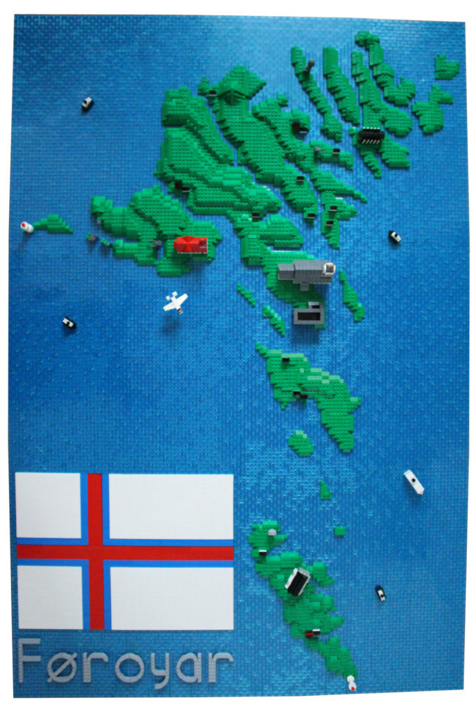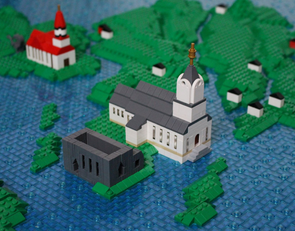
This is a Lego Map of the Faroe Islands (Føroyar) created by Lasse Vestergård. Based on the collection of islands north of the United Kingdom, and south of Iceland. A little over 52,000 people live in this Danish territory. This Lego map was built for an exhibition on the islands in 2019. The build features 3D buildings representing famous landmarks. A few of these building include Tórshavn Cathedral, the ruined Magnus Cathedral, and the red roofed Sandavágur Church. The flag has been recreated in the left corner, a great way to fill in the empty ocean. A variety of boats and airplanes can be found around the map. The finished build is probably 75% transparent blue. To break up the flat texture of the 1×2 plates, 1×1 round pieces have been scattered around. The end result is a very clean looking Lego Map.
You can read about more details, and see more photos of this Faroe Islands (Føroyar) Lego Map over here: https://www.flickr.com/photos/66344850@N06/49952957516/